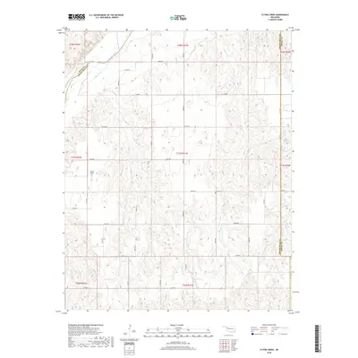
2018 Map of Flying Creek
USGS Topo · Published 2018About this map
The Canadian River cuts through the northwest corner of this Dewey County landscape, defining a terrain of dissected plains and seasonal drainage. This 2018 survey captures the rural character of the region, where a precise grid of sectional roads like N2000 Rd and E0750 Rd provides access to remote homesteads and agricultural tracts. For those tracing family histories or early rural settlements, the map identifies local landmarks such as Center Chapel Cem and Shirley Cem, which serve as quiet anchors for the surrounding community. Several significant waterways, including Flying Cr and Powwow Cr, carve through the topography, illustrating the natural water management patterns that have shaped land use since the area was first settled.
Find a feature on this map
37 named features on this map. Tap any name to fly to it.
Don’t see what you’re looking for? This feature index may not catch every label — zoom into the map to look around manually.
Map Details
Editions of this 2018 Flying Creek Map
This is the sole edition of this map. No revisions or reprints were ever made.
Other maps of this area

1955 · Clinton
USGS Topo · 1:250,000

1955 · Woodward
USGS Topo · 1:250,000

1957 · Clinton
USGS Topo · 1:250,000

1958 · Woodward
USGS Topo · 1:250,000

1961 · Leedey
USGS Topo · 1:62,500

1965 · Roll NE
USGS Topo · 1:24,000

1966 · Roll SE
USGS Topo · 1:24,000

1969 · Camargo
USGS Topo · 1:24,000
1970 · Harmon SE
USGS Topo · 1:24,000
1970 · Vici SW
USGS Topo · 1:24,000