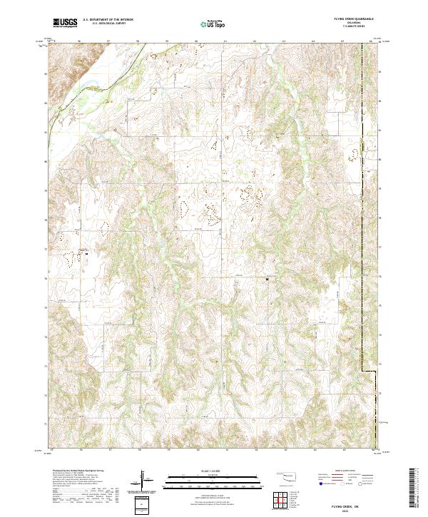
2022 Map of Flying Creek
USGS Topo · Published 2022About this map
The Canadian River cuts through the northwest corner of this terrain, marking a boundary where Roger Mills and Ellis counties meet. This landscape is defined by the deep drainage networks of Flying Cr and Powwow Cr, which carve through the high plains toward the river valley. The section-line road system, including routes like N2000 Rd and E0750 Rd, reveals the enduring grid of Oklahoma's land survey system. Local history is anchored by the Center Chapel Cem and Shirley Cem, which serve as quiet markers of the rural families who settled this area of western Oklahoma. The map also captures the convergences of several townships, illustrating how county lines and township boundaries like t17n r21w overlay the natural topography of Red Cr and Hay Cr.
Find a feature on this map
37 named features on this map. Tap any name to fly to it.
Don’t see what you’re looking for? This feature index may not catch every label — zoom into the map to look around manually.
Map Details
Editions of this 2022 Flying Creek Map
This is the sole edition of this map. No revisions or reprints were ever made.
Other maps of this area

1955 · Clinton
USGS Topo · 1:250,000

1955 · Woodward
USGS Topo · 1:250,000

1957 · Clinton
USGS Topo · 1:250,000

1958 · Woodward
USGS Topo · 1:250,000

1961 · Leedey
USGS Topo · 1:62,500

1965 · Roll NE
USGS Topo · 1:24,000

1966 · Roll SE
USGS Topo · 1:24,000

1969 · Camargo
USGS Topo · 1:24,000
1970 · Harmon SE
USGS Topo · 1:24,000
1970 · Vici SW
USGS Topo · 1:24,000