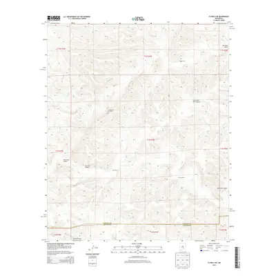
2013 Map of Flying H NE
USGS Topo · Published 2013About this map
Watson Ranch and Treat Ranch occupy a landscape defined by deep drainage systems and high desert terrain in this section of Chaves County. The map details the complex natural topography of the Pecos Valley region, where several major canyon systems converge. To the north, Twin Butte Canyon and Little Twin Butte Canyon cut through the limestone ridges, while Border Hill stands as a prominent landmark for travelers moving through this arid territory.
Find a feature on this map
25 named features on this map. Tap any name to fly to it.
Don’t see what you’re looking for? This feature index may not catch every label — zoom into the map to look around manually.
Map Details
Editions of this 2013 Flying H NE Map
This is the sole edition of this map. No revisions or reprints were ever made.
Other maps of this area

1955 · Roswell
USGS Topo · 1:250,000

1958 · Roswell
USGS Topo · 1:250,000

1961 · Flying H
USGS Topo · 1:62,500

1961 · Indian Bluff
USGS Topo · 1:62,500

1961 · Tinnie
USGS Topo · 1:62,500

1962 · Roswell
USGS Topo · 1:250,000

1962 · Horseshoe Bend
USGS Topo · 1:62,500

1979 · Roswell
USGS Topo · 1:100,000

1984 · Ruidoso
USGS Topo · 1:100,000
1988 · Sunset
USGS Topo · 1:24,000