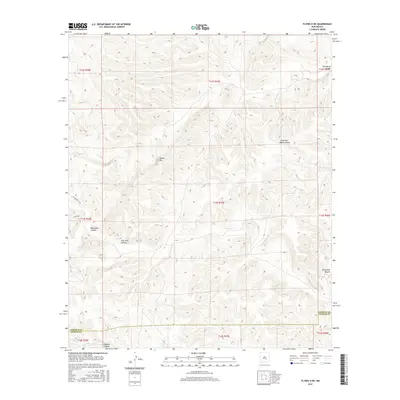
2017 Map of Flying H NE
USGS Topo · Published 2017About this map
Border Hill stands as a prominent landmark in this high-desert landscape, located near the border of Lincoln and Chaves counties. This 2017 survey reveals a complex network of drainage systems and dry washes typical of southeastern New Mexico, including Little Twin Butte Canyon and Twin Butte Canyon to the northeast. The terrain is deeply incised by multiple canyons such as Pine Tree Canyon and Monument Canyon, which both run through the central and eastern portions of the map. In the southern reach, Crooked Cr meanders through Crooked Canyon just as it crosses the Lincoln and Chaves county line. The map primarily documents the intricate topography of the public land survey system, illustrating the townships and ranges that organize this sparsely populated region where only a few rural routes, like Co RD e028, provide access through the ridges.
Find a feature on this map
19 named features on this map. Tap any name to fly to it.
Don’t see what you’re looking for? This feature index may not catch every label — zoom into the map to look around manually.
Map Details
Editions of this 2017 Flying H NE Map
This is the sole edition of this map. No revisions or reprints were ever made.
Other maps of this area

1955 · Roswell
USGS Topo · 1:250,000

1958 · Roswell
USGS Topo · 1:250,000

1961 · Flying H
USGS Topo · 1:62,500

1961 · Indian Bluff
USGS Topo · 1:62,500

1961 · Tinnie
USGS Topo · 1:62,500

1962 · Roswell
USGS Topo · 1:250,000

1962 · Horseshoe Bend
USGS Topo · 1:62,500

1979 · Roswell
USGS Topo · 1:100,000

1984 · Ruidoso
USGS Topo · 1:100,000
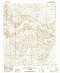
1988 · Sunset
USGS Topo · 1:24,000