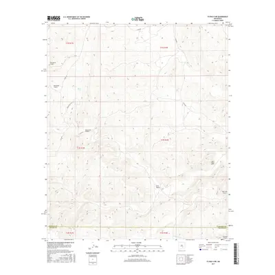
2017 Map of Flying H NW
USGS Topo · Published 2017About this map
Skeen Ranch Airport sits in the eastern reaches of this high-desert landscape where Chaves and Lincoln counties meet. The terrain is defined by a dense network of drainage systems including Monument Canyon, Chivo Canyon, and Twin Butte Canyon, which cut through the limestone ridges of the Sacramento Mountains foothills. This 2017 survey reflects a remote ranching economy dependent on scattered water sources like Shack Tank and the seasonal flows of Crooked Cr. While modern roads like Co RD e031 and Pancho Peaks Rd provide access, the underlying public land survey system reveals the traditional township and range grid that has governed New Mexico land use for generations. The map's detail provides researchers a clear view of the complex topography and sparse human infrastructure in this section of the Pecos River watershed.
Find a feature on this map
20 named features on this map. Tap any name to fly to it.
Don’t see what you’re looking for? This feature index may not catch every label — zoom into the map to look around manually.
Map Details
Editions of this 2017 Flying H NW Map
This is the sole edition of this map. No revisions or reprints were ever made.
Other maps of this area

1955 · Roswell
USGS Topo · 1:250,000

1958 · Roswell
USGS Topo · 1:250,000

1961 · Flying H
USGS Topo · 1:62,500

1961 · Lincoln
USGS Topo · 1:62,500

1961 · Tinnie
USGS Topo · 1:62,500

1962 · Roswell
USGS Topo · 1:250,000

1963 · Clements Ranch
USGS Topo · 1:24,000

1963 · Deadman Lake
USGS Topo · 1:24,000

1984 · Ruidoso
USGS Topo · 1:100,000
1988 · Sunset
USGS Topo · 1:24,000