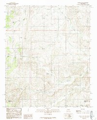
1989 Map of Flying H NW
USGS Topo · Published 1989About this map
Twin Butte Canyon and Monument Canyon dominate this high-desert landscape in the late 1980s, revealing a terrain defined by its complex drainage systems and water scarcity. This part of New Mexico, situated along the boundary between Lincoln County and Chaves County, showcases a traditional ranching infrastructure where water sources are the primary named landmarks. Essential wells such as Sulphur Well, Middle Well, and Cedar Hill Well are scattered throughout the draws, serving as vital anchor points for land management.
Find a feature on this map
17 named features on this map. Tap any name to fly to it.
Don’t see what you’re looking for? This feature index may not catch every label — zoom into the map to look around manually.
Map Details
Editions of this 1989 Flying H NW Map
This is the sole edition of this map. No revisions or reprints were ever made.
Other maps of this area

1955 · Roswell
USGS Topo · 1:250,000

1958 · Roswell
USGS Topo · 1:250,000

1961 · Flying H
USGS Topo · 1:62,500

1961 · Lincoln
USGS Topo · 1:62,500

1961 · Tinnie
USGS Topo · 1:62,500

1962 · Roswell
USGS Topo · 1:250,000

1963 · Clements Ranch
USGS Topo · 1:24,000

1963 · Deadman Lake
USGS Topo · 1:24,000

1984 · Ruidoso
USGS Topo · 1:100,000
1988 · Sunset
USGS Topo · 1:24,000