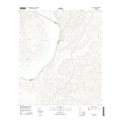
2014 Map of Flynns Lake
USGS Topo · Published 2014About this map
The Alabama River carves a deep, winding boundary between Clarke and Monroe counties, defining the landscape of this 2014 survey. High elevation points like Marshalls Bluff overlook the water, while river features such as Flynn Bar indicate the shifting sediment and navigation challenges of the waterway. The area known as Barlow Bend is characterized by its intricate drainage networks, including Flynns Lake Cr and the nearby Flynns Lake.
Find a feature on this map
31 named features on this map. Tap any name to fly to it.
Don’t see what you’re looking for? This feature index may not catch every label — zoom into the map to look around manually.
Map Details
Editions of this 2014 Flynns Lake Map
This is the sole edition of this map. No revisions or reprints were ever made.
Other maps of this area

1953 · Andalusia
USGS Topo · 1:250,000

1957 · Andalusia
USGS Topo · 1:250,000

1972 · Frisco City
USGS Topo · 1:24,000

1972 · Uriah East
USGS Topo · 1:24,000

1972 · Mexia
USGS Topo · 1:24,000

1972 · Chrysler
USGS Topo · 1:24,000

1972 · Uriah West
USGS Topo · 1:24,000

1972 · Flynns Lake
USGS Topo · 1:24,000

1972 · Gainestown
USGS Topo · 1:24,000

1972 · Claiborne
USGS Topo · 1:24,000