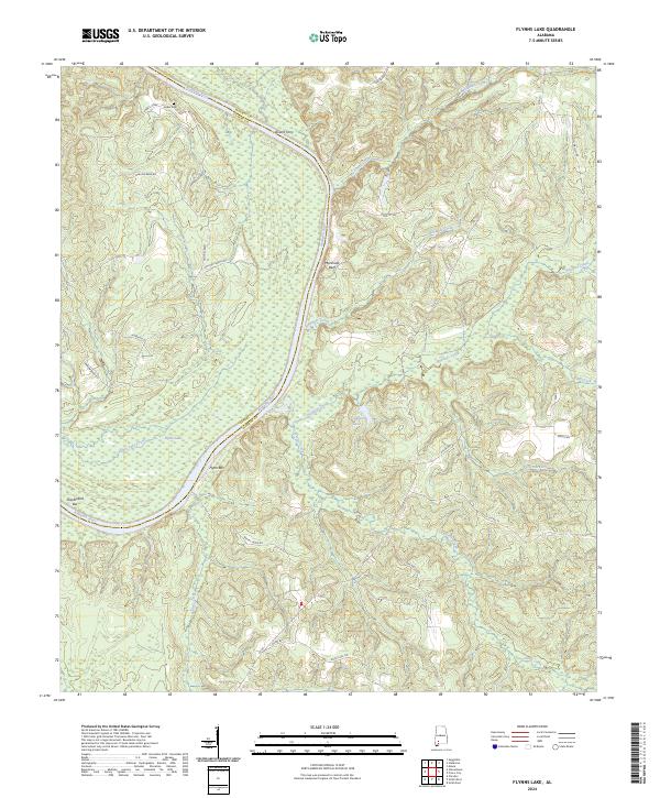
2024 Map of Flynns Lake
USGS Topo · Published 2024About this map
The Alabama River carves a deep, winding path through the borderlands of Monroe and Clarke counties, defining a landscape shaped by fluvial dynamics and early river transit. Evidence of historical river crossings and navigation is found in landmarks like Olivers Ferry and Marshalls Bluff, while Flynns Bar and Shackleford Bar indicate the shifting sediment of the river channel. Genealogists and local historians will find the Linder Cem tucked away near Linda's Creek, a small but significant site of family history in this heavily wooded river basin.
Find a feature on this map
41 named features on this map. Tap any name to fly to it.
Don’t see what you’re looking for? This feature index may not catch every label — zoom into the map to look around manually.
Map Details
Editions of this 2024 Flynns Lake Map
This is the sole edition of this map. No revisions or reprints were ever made.
Other maps of this area

1953 · Andalusia
USGS Topo · 1:250,000

1957 · Andalusia
USGS Topo · 1:250,000

1972 · Frisco City
USGS Topo · 1:24,000

1972 · Uriah East
USGS Topo · 1:24,000

1972 · Mexia
USGS Topo · 1:24,000

1972 · Chrysler
USGS Topo · 1:24,000

1972 · Uriah West
USGS Topo · 1:24,000

1972 · Flynns Lake
USGS Topo · 1:24,000

1972 · Gainestown
USGS Topo · 1:24,000

1972 · Claiborne
USGS Topo · 1:24,000