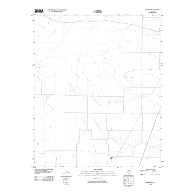
2010 Map of Foard City
USGS Topo · Published 2010About this map
Foard City serves as the primary focal point of this rural North Texas landscape, situated at the junction of several farm-to-market and county roads including FM 263 and Co RD 337. The terrain is defined by a dendritic network of drainages that feed into the larger basins of Beaver Creek and Middle Beaver Creek. To the north, the topographic prominence of Dixie Mound stands out from the surrounding plains, while the northern boundary of the area is traversed by Highway 70. The map reveals a strictly rural economy where large-scale ranching and agriculture are supported by named waterways like Little Good Creek, Raggedy Creek, and Salt Flat Creek. A dense grid of section-line roads, such as Co RD 334 and Co RD 354, provides access to the interior reaches of these Foard County ranchlands.
Find a feature on this map
32 named features on this map. Tap any name to fly to it.
Don’t see what you’re looking for? This feature index may not catch every label — zoom into the map to look around manually.
Map Details
Editions of this 2010 Foard City Map
This is the sole edition of this map. No revisions or reprints were ever made.
Other maps of this area

1932 · Vivian
USGS Topo · 1:62,500

1954 · Wichita Falls
USGS Topo · 1:250,000

1955 · Lawton
USGS Topo · 1:250,000

1958 · Wichita Falls
USGS Topo · 1:250,000

1958 · Medicine Mound
USGS Topo · 1:62,500

1960 · Teacup Mountain
USGS Topo · 1:62,500

1966 · Truscott North
USGS Topo · 1:24,000

1966 · Halsell Ranch
USGS Topo · 1:24,000

1966 · Big Four Ranch
USGS Topo · 1:24,000

1966 · Crowell
USGS Topo · 1:24,000