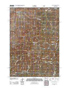
2011 Map of Foley Butte
USGS Topo · Published 2011About this map
Foley Butte Lookout Tower commands the high ground of this Jefferson County landscape, serving as a primary point of orientation for the network of Forest Service and local roads that thread through the high desert and timber. The terrain is defined by prominent volcanic features like Foley Butte and Awbrey Mountain, which channel numerous seasonal drainages and creek systems including Foley Creek, Higgins Creek, and Little Willow Creek.
Find a feature on this map
32 named features on this map. Tap any name to fly to it.
Don’t see what you’re looking for? This feature index may not catch every label — zoom into the map to look around manually.
Map Details
Editions of this 2011 Foley Butte Map
This is the sole edition of this map. No revisions or reprints were ever made.
Other maps of this area

1948 · Ochoco Reservoir
USGS Topo · 1:62,500

1950 · Ochoco Reservoir
USGS Topo · 1:62,500

1955 · Bend
USGS Topo · 1:250,000

1957 · Bend
USGS Topo · 1:250,000

1958 · Bend
USGS Topo · 1:250,000

1962 · Prineville
USGS Topo · 1:62,500

1968 · Axehandle Butte
USGS Topo · 1:24,000

1968 · Dutchman Creek
USGS Topo · 1:24,000

1968 · Ashwood
USGS Topo · 1:24,000
1969 · Brewer Reservoir
USGS Topo · 1:24,000