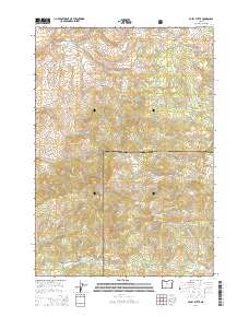
2014 Map of Foley Butte
USGS Topo · Published 2014About this map
Ochoco National Forest anchors the landscape of central Oregon at the border of Jefferson and Crook counties. This high-elevation terrain is defined by the Ochoco Mountains, where peaks like Foley Butte and Awbrey Mtn rise above a complex network of seasonal drainages and springs. The map reveals a high-desert forest environment where water is the primary geographic marker, highlighted by numerous remote sources such as Eleven Spring, Rainbow Trough Spring, and Bills Spring. The road network is primarily composed of forest service routes, including SE Boardtree Rd and SE Burma Rd, which facilitate movement through the varied topography. Distinctive landmarks like Sheep Rock and the deep Boiler Draw illustrate the erosional character of this volcanic region, providing specific points of interest for those studying the natural history or land use patterns of these national forest lands in the early twenty-first century.
Find a feature on this map
35 named features on this map. Tap any name to fly to it.
Don’t see what you’re looking for? This feature index may not catch every label — zoom into the map to look around manually.
Map Details
Editions of this 2014 Foley Butte Map
This is the sole edition of this map. No revisions or reprints were ever made.
Other maps of this area

1948 · Ochoco Reservoir
USGS Topo · 1:62,500

1950 · Ochoco Reservoir
USGS Topo · 1:62,500

1955 · Bend
USGS Topo · 1:250,000

1957 · Bend
USGS Topo · 1:250,000

1958 · Bend
USGS Topo · 1:250,000

1962 · Prineville
USGS Topo · 1:62,500

1968 · Axehandle Butte
USGS Topo · 1:24,000

1968 · Dutchman Creek
USGS Topo · 1:24,000

1968 · Ashwood
USGS Topo · 1:24,000
1969 · Brewer Reservoir
USGS Topo · 1:24,000