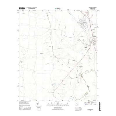
2014 Map of Folkston
USGS Topo · Published 2014About this map
The Saint Marys River winds along the southeastern border of this Charlton County landscape, marking the historic boundary between Georgia and Florida. This survey captures the rural character and transportation networks of the early 21st century, centered on the community of Folkston and the neighboring town of Homeland. The area's deep history is reflected in the numerous family and community burial grounds, such as Traders Hill Cem and Sardis Cem, which are scattered throughout the countryside. Along the river, Traders Hill and Stanley Landing point to the region's long-standing connection to the waterway, while the Ferry Landing remains a notable landmark of river travel. Further inland, the distinctive topography of Trail Ridge rises above the lowlands, and smaller settlements like Paxton and Oakdale are linked by a network of local roads such as Spanish Creek Rd and Old Dixie Hwy.
Find a feature on this map
116 named features on this map. Tap any name to fly to it.
Don’t see what you’re looking for? This feature index may not catch every label — zoom into the map to look around manually.
Map Details
Editions of this 2014 Folkston Map
This is the sole edition of this map. No revisions or reprints were ever made.
Other maps of this area

1917 · Boulogne
USGS Topo · 1:62,500

1917 · Hilliard
USGS Topo · 1:62,500

1918 · Folkston
USGS Topo · 1:62,500

1918 · Moniac
USGS Topo · 1:62,500

1919 · Hilliard
USGS Topo · 1:62,500

1919 · Boulogne
USGS Topo · 1:62,500

1942 · Moniac
USGS Topo · 1:62,500

1948 · Jacksonville
USGS Topo · 1:250,000

1954 · Valdosta
USGS Topo · 1:250,000

1957 · Jacksonville
USGS Topo · 1:250,000