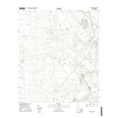
2017 Map of Folkston
USGS Topo · Published 2017About this map
Folkston and Homeland anchor this corridor in Charlton County, Georgie, where the Saint Marys River forms the state line with Florida. The landscape is defined by the high ground of Trail Ridge to the west and a complex network of waterways including Spanish Cr and Stanley Br. Historically significant sites are scattered throughout the rural periphery, most notably the river-oriented settlement at Traders Hill, which served as a critical early commerce point and county seat. Genealogy researchers will find numerous small burial grounds across the quadrangle, such as Bethel Cem, Sardis Cem, and the Prospect Cem near Gowen Lake. The map details the local road system, including Tracys Ferry Rd and Bryant Landing Rd, reflecting the area's long-standing connection to the river and its swampy margins.
Find a feature on this map
132 named features on this map. Tap any name to fly to it.
Don’t see what you’re looking for? This feature index may not catch every label — zoom into the map to look around manually.
Map Details
Editions of this 2017 Folkston Map
This is the sole edition of this map. No revisions or reprints were ever made.
Other maps of this area

1917 · Boulogne
USGS Topo · 1:62,500

1917 · Hilliard
USGS Topo · 1:62,500

1918 · Folkston
USGS Topo · 1:62,500

1918 · Moniac
USGS Topo · 1:62,500

1919 · Hilliard
USGS Topo · 1:62,500

1919 · Boulogne
USGS Topo · 1:62,500

1942 · Moniac
USGS Topo · 1:62,500

1948 · Jacksonville
USGS Topo · 1:250,000

1954 · Valdosta
USGS Topo · 1:250,000

1957 · Jacksonville
USGS Topo · 1:250,000