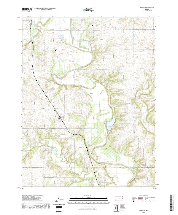
2022 Map of Fontana
USGS Topo · Published 2022About this map
The Marais des Cygnes River winds through this Miami County landscape, carving a broad valley that defines the local topography south of Fontana. This modern survey illustrates a rural Kansas environment where water management and conservation are central, highlighted by the presence of Miami County State Lake and smaller bodies like Hunters Lake. The settlement of Fontana remains the primary hub, situated near the intersection of N Osage St and W 387th St.
Find a feature on this map
61 named features on this map. Tap any name to fly to it.
Don’t see what you’re looking for? This feature index may not catch every label — zoom into the map to look around manually.
Map Details
Editions of this 2022 Fontana Map
This is the sole edition of this map. No revisions or reprints were ever made.
Other maps of this area

1887 · Olathe
USGS Topo · 1:125,000

1887 · Mound City
USGS Topo · 1:125,000

1893 · Mound City
USGS Topo · 1:125,000

1893 · Olathe
USGS Topo · 1:125,000

1947 · Lawrence
USGS Topo · 1:250,000

1950 · Lawrence
USGS Topo · 1:250,000

1956 · Paola East
USGS Topo · 1:24,000

1956 · Lawrence
USGS Topo · 1:250,000
1957 · Paola West
USGS Topo · 1:24,000
1957 · Louisburg
USGS Topo · 1:24,000