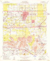
1953 Map of Fontana
USGS Topo · Published 1955About this map
The Kaiser Steel Plant and Kaiser Siding dominate the western industrial corridor of this mid-century landscape, reflecting the post-war industrial surge in San Bernardino County. Heavy industry is balanced by the dense network of civic infrastructure in Fontana and Bloomington, where numerous neighborhood schools like Randall Pepper Sch and Lewis Sch serve the expanding residential tracts. This era shows a community in transition, with citrus-aligned grid systems beginning to give way to suburban development.
Find a feature on this map
72 named features on this map. Tap any name to fly to it.
Don’t see what you’re looking for? This feature index may not catch every label — zoom into the map to look around manually.
Map Details
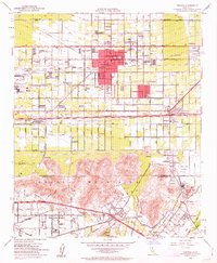
Editions of this 1953 Fontana Map
2 editions found
Other maps of this area

1896 · San Bernardino
USGS Topo · 1:62,500

1897 · Cucamonga
USGS Topo · 1:62,500

1898 · San Bernardino
USGS Topo · 1:62,500

1900 · Cucamonga
USGS Topo · 1:62,500

1901 · Southern California Sheet No. 1
USGS Topo · 1:250,000

1901 · San Bernardino
USGS Topo · 1:62,500

1901 · Elsinore
USGS Topo · 1:125,000

1901 · Riverside
USGS Topo · 1:62,500

1902 · Corona
USGS Topo · 1:125,000

1903 · Cucamonga
USGS Topo · 1:62,500