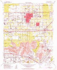
1953 Map of Fontana
USGS Topo · Published 1963About this map
The Kaiser Steel Plant anchors the industrial landscape of the western valley, a massive facility with its own hospital and administrative buildings near Kaiser Siding. This mid-century view shows the region at a peak of rail-dependent growth, with the Pacific Electric, Atchison Topeka and Santa Fe, and Southern Pacific lines all intersecting this active corridor. The city of Fontana serves as the central hub, surrounded by a dense grid of schools like Randall-Pepper Sch and North Tamarind Sch. To the south, the Jurupa Mountains rise abruptly from the valley floor, marked by extensive mining operations such as the Crestmore Quarry and Jensen Quarry. Along the Santa Ana River, smaller communities like Rubidoux and Belltown maintain a distinct riverside character away from the heavy industrial zones of the north.
Find a feature on this map
62 named features on this map. Tap any name to fly to it.
Don’t see what you’re looking for? This feature index may not catch every label — zoom into the map to look around manually.
Map Details
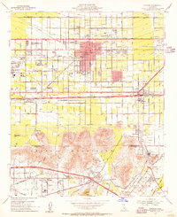
Editions of this 1953 Fontana Map
2 editions found
Other maps of this area

1896 · San Bernardino
USGS Topo · 1:62,500

1897 · Cucamonga
USGS Topo · 1:62,500

1898 · San Bernardino
USGS Topo · 1:62,500

1900 · Cucamonga
USGS Topo · 1:62,500

1901 · Southern California Sheet No. 1
USGS Topo · 1:250,000

1901 · San Bernardino
USGS Topo · 1:62,500

1901 · Elsinore
USGS Topo · 1:125,000

1901 · Riverside
USGS Topo · 1:62,500

1902 · Corona
USGS Topo · 1:125,000

1903 · Cucamonga
USGS Topo · 1:62,500