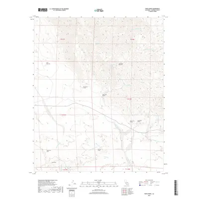
2018 Map of Fonts Point
USGS Topo · Published 2018About this map
Fonts Point overlooks a complex desert landscape where the Borrego Valley meets the southern reaches of the Santa Rosa Mountains. This 2018 survey reveals a drainage system defined by a dense network of washes, such as Travertine Palms Wash, Wonderstone Wash, and Vista del Malpais Wash, which have carved deep canyons like Rattlesnake Canyon and Coachwhip Canyon. High ground at Inspiration Point provides a vantage over the deeply eroded badlands and the ephemeral hydrology of Little Clark Lake. The map details critical water sources in this arid environment, including Rattlesnake Spring, Palo Verde Spring, and Natural Rock Tanks, illustrating how water has historically dictated movement and land use throughout these San Diego County desert tracts.
Find a feature on this map
32 named features on this map. Tap any name to fly to it.
Don’t see what you’re looking for? This feature index may not catch every label — zoom into the map to look around manually.
Map Details
Editions of this 2018 Fonts Point Map
This is the sole edition of this map. No revisions or reprints were ever made.
Other maps of this area

1904 · Indio
USGS Topo · 1:125,000

1931 · Vallecito
USGS Topo · 1:125,000

1939 · Borrego
USGS Topo · 1:62,500

1941 · Clark Lake
USGS Topo · 1:62,500

1942 · Barrel Spring
USGS Topo · 1:62,500

1942 · Agua Dulce
USGS Topo · 1:62,500

1942 · Clark Lake
USGS Topo · 1:62,500

1942 · Borego
USGS Topo · 1:62,500

1943 · Vallecito
USGS Topo · 1:125,000

1944 · Agua Dulce
USGS Topo · 1:62,500