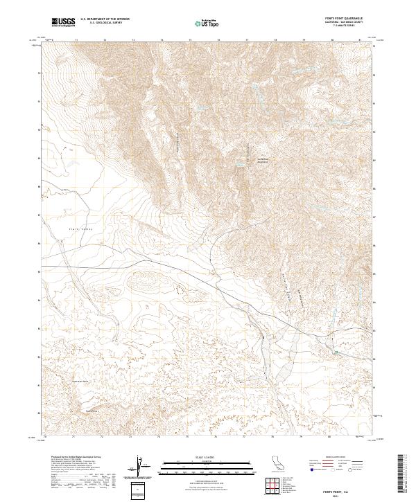
2021 Map of Fonts Point
USGS Topo · Published 2021About this map
Fonts Point and Inspiration Point anchor the southern reaches of this arid landscape, overlooking the expansive Clark Valley below. The terrain is a complex network of seasonal drainage systems and steep topography, carved into the Santa Rosa Mountains and its foothills. Rare water sources like Rattlesnake Spring and Palo Verde Spring stand out as critical landmarks in an environment defined by deep erosion, seen in the winding paths of Smoke Tree Canyon and Coachwhip Canyon. The northern portion of the map is dominated by the high-relief ridges and the broad Travertine Palms Wash, which flows toward the northeast. This modern survey illustrates the natural barriers and hydraulic patterns of the desert, showing how water has historically shaped the travel corridors and naming conventions of this part of San Diego County.
Find a feature on this map
20 named features on this map. Tap any name to fly to it.
Don’t see what you’re looking for? This feature index may not catch every label — zoom into the map to look around manually.
Map Details
Editions of this 2021 Fonts Point Map
This is the sole edition of this map. No revisions or reprints were ever made.
Other maps of this area

1904 · Indio
USGS Topo · 1:125,000

1931 · Vallecito
USGS Topo · 1:125,000

1939 · Borrego
USGS Topo · 1:62,500

1941 · Clark Lake
USGS Topo · 1:62,500

1942 · Barrel Spring
USGS Topo · 1:62,500

1942 · Agua Dulce
USGS Topo · 1:62,500

1942 · Clark Lake
USGS Topo · 1:62,500

1942 · Borego
USGS Topo · 1:62,500

1943 · Vallecito
USGS Topo · 1:125,000

1944 · Agua Dulce
USGS Topo · 1:62,500