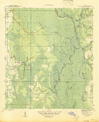
1945 Map of Forbes Island
USGS Topo · Published 1945About this map
The Apalachicola River and the winding Brothers River dominate this 1940s landscape where Liberty, Gulf, and Franklin counties meet. This region is defined by its water-based economy and timber history, evident in the network of river landings such as Hickory Landing, Brickyard Landing, and Smith Creek Landing. A Logging RR cuts through the western interior, connecting isolated sites like Lister Camp and Kenny Camp to the outside world. To the east, the Apalachicola National Forest covers much of the terrain, which is broken by numerous waterways like Owl Creek and Brickyard Cut Off. The map documents a time when river transport and rail-based logging were the primary drivers of settlement, long before modern development transformed Florida's panhandle.
Find a feature on this map
36 named features on this map. Tap any name to fly to it.
Don’t see what you’re looking for? This feature index may not catch every label — zoom into the map to look around manually.
Map Details
Editions of this 1945 Forbes Island Map
3 editions found
Other maps of this area

1943 · Jackson River
USGS Topo · 1:24,000

1944 · White City
USGS Topo · 1:24,000

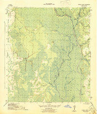
1944 · Forbes Island
USGS Topo · 1:24,000

1945 · Forbes Island
USGS Topo · 1:31,680

1945 · Lake Wimico
USGS Topo · 1:31,680

1945 · Kennedy Creek
USGS Topo · 1:31,680

1945 · White City
USGS Topo · 1:31,680

1945 · Beverly
USGS Topo · 1:31,680

1945 · Wewahitchka
USGS Topo · 1:31,680

1945 · Jackson River
USGS Topo · 1:31,680