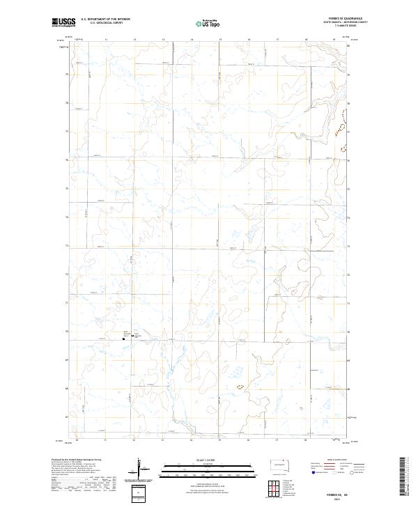
2021 Map of Forbes SE
USGS Topo · Published 2021About this map
McPherson County farmland is defined by a grid of rural section roads and intermittent watercourses in this topographical study. Located in the southeastern vicinity of Forbes, the landscape is primarily organized by a network of numbered avenues and streets, including 366th Ave and 105th St. Central to the local history of this prairie region are Saint Hyacinth Cem and Saint Hyacinth Cem 2, situated along 111th St. The natural drainage of the area is characterized by the winding path of Willow Cr in the south and the seasonal channel of Dry Run in the northeast. This map provides a clear record of land divisions and rural infrastructure, from the path of Co Hwy 23 to the numerous small depressions and wetland basins typical of the Glacial Lake Agassiz region's terminal moraine topography.
Find a feature on this map
27 named features on this map. Tap any name to fly to it.
Don’t see what you’re looking for? This feature index may not catch every label — zoom into the map to look around manually.
Map Details
Editions of this 2021 Forbes SE Map
This is the sole edition of this map. No revisions or reprints were ever made.
Other maps of this area

1894 · Ellendale
USGS Topo · 1:62,500

1899 · Ellendale
USGS Topo · 1:125,000

1954 · Aberdeen
USGS Topo · 1:250,000

1956 · Aberdeen
USGS Topo · 1:250,000
1968 · Frederick NW
USGS Topo · 1:24,000

1968 · Forbes
USGS Topo · 1:24,000

1968 · Forbes SE
USGS Topo · 1:24,000
1968 · Forbes NW
USGS Topo · 1:24,000

1968 · Forbes SW
USGS Topo · 1:24,000
1968 · Frederick SW
USGS Topo · 1:24,000