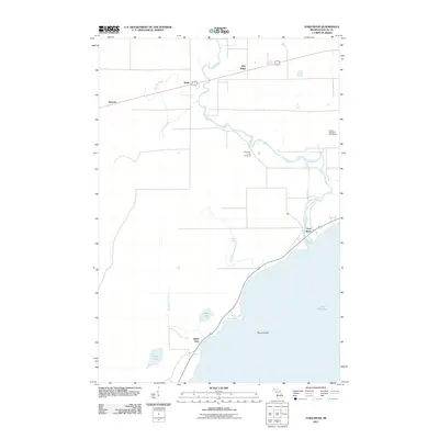
2011 Map of Ford River
USGS Topo · Published 2011About this map
The winding Ford River defines the drainage of this coastal Michigan landscape as it meets the shoreline of Lake Michigan. This 2011 survey documents a mix of low-lying wetlands and established rural settlements like Narenta and Hyde, which sit along the inland transportation corridor. Near the coast, the community of Island View looks out toward Round Island, situated between North Lake and the open bay. Local history is anchored by the West Ford River Cemetery, located north of the river's main bend, while more modern land use is visible at the Country Meadows Golf Course. The geography is characterized by several small tributaries, including the curiously named No See-um Creek and Fenlon Creek, which feed into the larger river system before it reaches the settlement of Ford River near the lake's edge.
Find a feature on this map
16 named features on this map. Tap any name to fly to it.
Don’t see what you’re looking for? This feature index may not catch every label — zoom into the map to look around manually.
Map Details
Editions of this 2011 Ford River Map
This is the sole edition of this map. No revisions or reprints were ever made.
Other maps of this area

1932 · Gladstone SE
USGS Topo · 1:31,680

1932 · Bark River NE
USGS Topo · 1:31,680

1932 · Whitney SE
USGS Topo · 1:31,680

1932 · Gladstone SW
USGS Topo · 1:31,680

1954 · Escanaba
USGS Topo · 1:250,000

1957 · Escanaba
USGS Topo · 1:250,000

1958 · Escanaba
USGS Topo · 1:250,000

1958 · Gladstone
USGS Topo · 1:62,500

1958 · Escanaba
USGS Topo · 1:62,500

1963 · Bark River
USGS Topo · 1:62,500