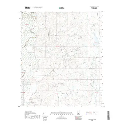
2020 Map of Fords Creek
USGS Topo · Published 2020About this map
The Pearl River carves a winding boundary between Mississippi and Louisiana in this 2020 topographic record, defining a landscape of wetlands and oxbow lakes. Numerous water bodies such as Horseshoe Lake, Road Lake, and Aaron Lake dot the western river bottoms, while Hunt Bluff provides a notable landmark overlooking the water. Moving away from the river, the terrain rises toward the namesake settlement of Fords Creek, where the land is partitioned into various tracts and rural lanes.
Find a feature on this map
69 named features on this map. Tap any name to fly to it.
Don’t see what you’re looking for? This feature index may not catch every label — zoom into the map to look around manually.
Map Details
Editions of this 2020 Fords Creek Map
This is the sole edition of this map. No revisions or reprints were ever made.
Other maps of this area

1949 · Bogalusa East
USGS Topo · 1:31,680

1949 · Angie
USGS Topo · 1:31,680

1953 · Hattiesburg
USGS Topo · 1:250,000

1953 · Mobile
USGS Topo · 1:250,000

1957 · Mobile
USGS Topo · 1:250,000

1958 · Hattiesburg
USGS Topo · 1:250,000

1959 · Bogalusa
USGS Topo · 1:62,500

1959 · Poplarville
USGS Topo · 1:62,500

1960 · Mobile
USGS Topo · 1:250,000

1963 · Mobile
USGS Topo · 1:250,000