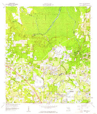
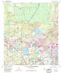
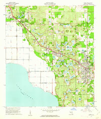
1959 Map of Forest City
USGS Topo · Published 1961About this map
Wekiva Springs and the headwaters of the Wekiva River dominate the northern landscape of this Central Florida study, where the boundary between Orange and Seminole counties is clearly defined. The area shows a transition from the wooded wetlands of the north to the expanding residential and agricultural pockets of Forest City and Apopka in the south. The transportation network is anchored by the Atlantic Coast Line and Seaboard Air Line railroads, which facilitated the movement of goods and people through settlements like Piedmont and Maitland. Numerous spring-fed lakes, including Bear Lake and Lake Lotus, dot the terrain, reflecting the region's characteristic hydrology. Notable local landmarks such as the Altamonte Springs Sch, Mt Tabor Ch, and the Mid-Florida Golf Course provide specific points of interest for those researching mid-century community development and local genealogy.
Find a feature on this map
81 named features on this map. Tap any name to fly to it.
Don’t see what you’re looking for? This feature index may not catch every label — zoom into the map to look around manually.
Map Details
Editions of this 1959 Forest City Map
5 editions found
Other maps of this area

1955 · Orlando
USGS Topo · 1:250,000
1956 · Winter Garden
USGS Topo · 1:24,000
1956 · Orlando West
USGS Topo · 1:24,000
1956 · Orlando East
USGS Topo · 1:24,000

1957 · Orlando
USGS Topo · 1:250,000

1958 · Orlando
USGS Topo · 1:250,000

1960 · Sorrento
USGS Topo · 1:24,000
1960 · Apopka
USGS Topo · 1:24,000

1962 · Orlando
USGS Topo · 1:250,000
1962 · Casselberry
USGS Topo · 1:24,000