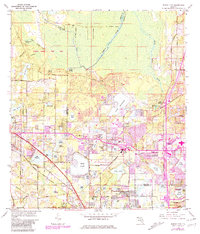
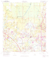
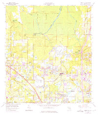
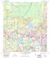
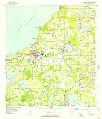
1959 Map of Forest City
USGS Topo · Published 1981About this map
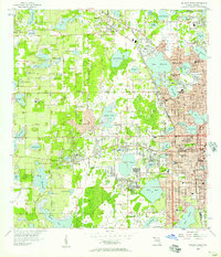
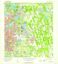
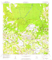
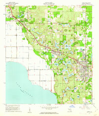
Wekiwa Springs State Park and the headwaters of the Wekiwa River anchor this landscape along the border of Orange and Seminole counties. The area exhibits a significant transition from the conservation lands around Wekiwa Springs and Witherington Spring in the north to the rapidly expanding residential developments of Altamonte Springs and Longwood in the south. Purple revisions from the late 1970s illustrate the post-war suburban transformation, showing the dense street networks of Weathersfield and Riverside Acres alongside long-standing local institutions like Forest Lake Academy.
Find a feature on this map
85 named features on this map. Tap any name to fly to it.
Don’t see what you’re looking for? This feature index may not catch every label — zoom into the map to look around manually.
Map Details
Editions of this 1959 Forest City Map
5 editions found
Other maps of this area

1955 · Orlando
USGS Topo · 1:250,000
1956 · Winter Garden
USGS Topo · 1:24,000
1956 · Orlando West
USGS Topo · 1:24,000
1956 · Orlando East
USGS Topo · 1:24,000

1957 · Orlando
USGS Topo · 1:250,000

1958 · Orlando
USGS Topo · 1:250,000
1959 · Forest City
USGS Topo · 1:24,000

1960 · Sorrento
USGS Topo · 1:24,000
1960 · Apopka
USGS Topo · 1:24,000

1962 · Orlando
USGS Topo · 1:250,000