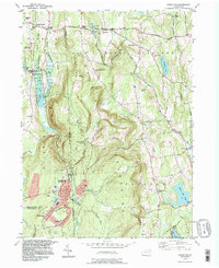
1994 Map of Forest City
USGS Topo · Published 1996About this map
The Lackawanna River headwaters define this northeastern Pennsylvania landscape, where the West Branch and East Branch converge near Stillwater Lake. By the mid-1990s, the borough of Forest City serves as the southern anchor of the map, established on the border where Susquehanna and Lackawanna counties meet. The terrain transitions from the valley floors of the river into the Clinton Mountains and Mount Pleasant, characterized by high-elevation water bodies like Hankins Pond and White Oak Pond. Local history is preserved through scattered rural landmarks such as St James Ch and the historic Old Newburgh Turnpike, while the southern reaches show the industrial and municipal footprint of Browndale and Vandling, including a Filtration Plant and Sew Disp Plant near the riverbanks.
Find a feature on this map
67 named features on this map. Tap any name to fly to it.
Don’t see what you’re looking for? This feature index may not catch every label — zoom into the map to look around manually.
Map Details
Editions of this 1994 Forest City Map
This is the sole edition of this map. No revisions or reprints were ever made.
Other maps of this area

1892 · Honesdale
USGS Topo · 1:62,500

1892 · Dundaff
USGS Topo · 1:62,500

1926 · Starrucca
USGS Topo · 1:62,500

1930 · Starrucca
USGS Topo · 1:48,000

1932 · Susquehanna
USGS Topo · 1:62,500

1933 · Starrucca
USGS Topo · 1:62,500

1935 · Susquehanna
USGS Topo · 1:62,500

1943 · Honesdale
USGS Topo · 1:125,000

1946 · Forest City
USGS Topo · 1:24,000

1946 · Carbondale
USGS Topo · 1:24,000