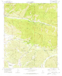
1970 Map of Forest Falls
USGS Topo · Published 1975About this map
Mountain Home Village and Forest Falls anchor the high-altitude landscape of the San Bernardino National Forest as it appeared in the early 1970s. This survey marks the critical Washington Monument (Original Initial Point), the surveyor's anchor for the San Bernardino Meridian. The complex hydrology of the region is evident in the path of the Yucaipa Aqueduct and the presence of the Pine Powerhouse in the southern canyon lands.
Find a feature on this map
63 named features on this map. Tap any name to fly to it.
Don’t see what you’re looking for? This feature index may not catch every label — zoom into the map to look around manually.
Map Details
Editions of this 1970 Forest Falls Map
3 editions found
Other maps of this area

1899 · Redlands
USGS Topo · 1:62,500

1901 · Southern California Sheet No. 1
USGS Topo · 1:250,000

1901 · San Jacinto
USGS Topo · 1:125,000

1901 · Redlands
USGS Topo · 1:62,500

1901 · Elsinore
USGS Topo · 1:125,000

1902 · San Gorgonio
USGS Topo · 1:125,000

1904 · Southern California Sheet No. 1
USGS Topo · 1:250,000

1942 · Banning
USGS Topo · 1:62,500

1942 · Perris
USGS Topo · 1:62,500

1943 · Perris
USGS Topo · 1:62,500