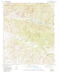
1970 Map of Forest Falls
USGS Topo · Published 1994About this map
Forest Falls and Valley of the Falls sit deep in the San Bernardino Mountains, flanking the drainage of Mill Creek. This map, based on late 1960s aerial photography with 1994 revisions, details a high-elevation landscape defined by steep ridges and canyon settlements. To the north, the San Gorgonio Wilderness remains roadless, marked only by paths like the Momyer Pack Trail and Vivian Creek Trail.
Find a feature on this map
49 named features on this map. Tap any name to fly to it.
Don’t see what you’re looking for? This feature index may not catch every label — zoom into the map to look around manually.
Map Details
Editions of this 1970 Forest Falls Map
3 editions found
Other maps of this area

1899 · Redlands
USGS Topo · 1:62,500

1901 · Southern California Sheet No. 1
USGS Topo · 1:250,000

1901 · San Jacinto
USGS Topo · 1:125,000

1901 · Redlands
USGS Topo · 1:62,500

1901 · Elsinore
USGS Topo · 1:125,000

1902 · San Gorgonio
USGS Topo · 1:125,000

1904 · Southern California Sheet No. 1
USGS Topo · 1:250,000

1942 · Banning
USGS Topo · 1:62,500

1942 · Perris
USGS Topo · 1:62,500

1943 · Perris
USGS Topo · 1:62,500