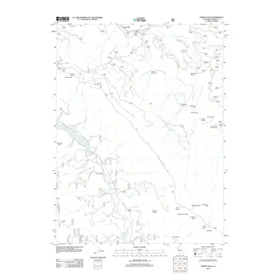
2012 Map of Forest Glen
USGS Topo · Published 2012About this map
S Fork Trinity River and the Mad River carve through this Trinity County landscape, creating a complex geography of ridges and flats. Near the northern boundary, Forest Glen and Taylor Flat sit along the Trinity, while the southern portion of the map is anchored by the community of Ruth. The terrain is marked by high-elevation points like Pickett Peak Lookout and Horse Ridge Lookout, providing vantage points over the surrounding basins. The area serves as a hub for backcountry access, evidenced by Pickett Peak Campground and Fern Campground. Transportation through the region follows the natural contours of the river valleys, with Mad River RD and Ruth Zenia RD connecting remote ranchlands like Terral Ranch to the more developed areas. The presence of the Silver Creek Ranch Airport highlights the importance of aerial access in this deeply corrugated mountain environment, where deep gulches like Clover Gulch break the rising slopes.
Find a feature on this map
78 named features on this map. Tap any name to fly to it.
Don’t see what you’re looking for? This feature index may not catch every label — zoom into the map to look around manually.
Map Details
Editions of this 2012 Forest Glen Map
This is the sole edition of this map. No revisions or reprints were ever made.
Other maps of this area

1918 · Anada
USGS Topo · 1:62,500

1921 · Hoaglin
USGS Topo · 1:62,500

1922 · Island Mountain
USGS Topo · 1:62,500

1931 · Hoaglin
USGS Topo · 1:96,000

1935 · Hoaglin
USGS Topo · 1:125,000

1953 · Blackrock Mtn
USGS Topo · 1:62,500

1954 · Pickett Peak
USGS Topo · 1:62,500

1954 · Dubakella Mtn
USGS Topo · 1:62,500

1954 · Blackrock Mtn
USGS Topo · 1:62,500
1955 · Kettenpom
USGS Topo · 1:62,500