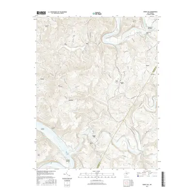
2016 Map of Forest Hill
USGS Topo · Published 2016About this map
The Greenbrier River and New River define the winding, mountainous landscape of the Summers and Monroe County border. This 2016 survey highlights the concentrated rural hamlets and family-named hollows that have endured for generations, including Bertha, Buck, and Forest Hill. The confluence of river and creek life is evident at the Mouth of Indian Creek Rd, while the area's geological character is marked by the Stony Creek Gorge and distinctive landmarks like the Devils Featherbed. Genealogists and local historians can trace legacy sites such as the Huffman Cem and Fairview Baptist Church Cem, or locate historic mineral water sites like Bargers Spring and Red Sulphur Spring. The road network, including the Red Sulphur Springs RD, connects these scattered settlements across high points like Wolf Creek Mtn and Bunker Hill, illustrating the complex topography of the West Virginia highlands.
Find a feature on this map
91 named features on this map. Tap any name to fly to it.
Don’t see what you’re looking for? This feature index may not catch every label — zoom into the map to look around manually.
Map Details
Editions of this 2016 Forest Hill Map
This is the sole edition of this map. No revisions or reprints were ever made.
Other maps of this area

1887 · Hinton
USGS Topo · 1:125,000

1890 · Dublin
USGS Topo · 1:125,000

1891 · Dublin
USGS Topo · 1:125,000

1892 · Hinton
USGS Topo · 1:125,000

1912 · Big Bend
USGS Topo · 1:62,500

1913 · Peterstown
USGS Topo · 1:48,000

1914 · Big Bend
USGS Topo · 1:62,500

1916 · Peterstown
USGS Topo · 1:62,500

1921 · Alderson
USGS Topo · 1:48,000

1923 · Pearisburg
USGS Topo · 1:62,500