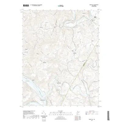
2019 Map of Forest Hill
USGS Topo · Published 2019About this map
The Greenbrier River carves a dramatic path through the center of this landscape, notably creating the horseshoe loop of Big Bend and the deep Stony Creek Gorge. Along its banks and the neighboring New River, small settlements like Bargers Springs and Crumps Bottom define a community structured by river valleys and ridges. Local genealogy is anchored by sites like the Fairview Baptist Church Cem and the Huffman Cem near Buck. The terrain is defined by prominent high points such as Wolf Creek Mtn and Big Bend Mtn, while the border between Summers Co and Monroe Co cuts through the southeastern corner near Indian Creek. This layout reveals how historical mountain roads like Seminole Rd and Barger Springs Rd followed the natural contours of the land to connect isolated villages like Marie and Bertha.
Find a feature on this map
94 named features on this map. Tap any name to fly to it.
Don’t see what you’re looking for? This feature index may not catch every label — zoom into the map to look around manually.
Map Details
Editions of this 2019 Forest Hill Map
This is the sole edition of this map. No revisions or reprints were ever made.
Other maps of this area

1887 · Hinton
USGS Topo · 1:125,000

1890 · Dublin
USGS Topo · 1:125,000

1891 · Dublin
USGS Topo · 1:125,000

1892 · Hinton
USGS Topo · 1:125,000

1912 · Big Bend
USGS Topo · 1:62,500

1913 · Peterstown
USGS Topo · 1:48,000

1914 · Big Bend
USGS Topo · 1:62,500

1916 · Peterstown
USGS Topo · 1:62,500

1921 · Alderson
USGS Topo · 1:48,000

1923 · Pearisburg
USGS Topo · 1:62,500