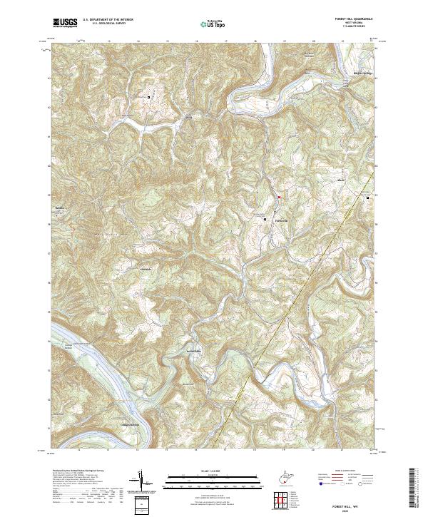
2023 Map of Forest Hill
USGS Topo · Published 2023About this map
The Greenbrier River carves a dramatic path through the Appalachian landscape, defining the topography of this corner of Summers County. Its course includes the sharp oxbow at Big Bend, flanked by the heights of Big Bend Mountain. Further south, the confluence of Indian Creek and the New River marks the lowlands of Crumps Bottom, an area of significance for early river valley settlement. The map reveals a network of upland communities like Forest Hill and Marie positioned along ridgeline roads, contrasting with river-oriented locations such as Bargers Springs near the Stony Creek Gorge. Genealogists will find several historical burial grounds and places of worship, including the Fairview Baptist Church Cem and the Huffman Cem. The terrain is characterized by deep drainages like Kate Hollow and Dickinson Hollow, which historically dictated the movement of goods and people between isolated farmsteads and rural post offices.
Find a feature on this map
94 named features on this map. Tap any name to fly to it.
Don’t see what you’re looking for? This feature index may not catch every label — zoom into the map to look around manually.
Map Details
Editions of this 2023 Forest Hill Map
This is the sole edition of this map. No revisions or reprints were ever made.
Other maps of this area

1887 · Hinton
USGS Topo · 1:125,000

1890 · Dublin
USGS Topo · 1:125,000

1891 · Dublin
USGS Topo · 1:125,000

1892 · Hinton
USGS Topo · 1:125,000

1912 · Big Bend
USGS Topo · 1:62,500

1913 · Peterstown
USGS Topo · 1:48,000

1914 · Big Bend
USGS Topo · 1:62,500

1916 · Peterstown
USGS Topo · 1:62,500

1921 · Alderson
USGS Topo · 1:48,000

1923 · Pearisburg
USGS Topo · 1:62,500