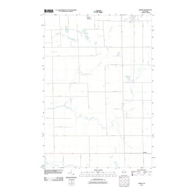
2010 Map of Forest
USGS Topo · Published 2010About this map
Willow River and its various tributaries, including Wolf Creek and Black Brook, dominate this rural landscape in Polk County. The settlement of Forest sits in the southeast corner, serving as a focal point for a dense grid of agricultural roads like County Hwy-H and Polk Saint Croix Rd. The northern reaches of the quadrangle are defined by a series of water bodies, most notably Bone Lake and Long Lake, along with the Don Dosch Wildlife Flowage Dam. The map reveals a highly structured drainage pattern where the South Fork Willow River and Hutton Creek converge in the south, reflecting the glacial topography of the region. This 2010 survey shows the area's established rural character, where large-scale hydrology management and a systematic township road network support the local farming economy.
Find a feature on this map
42 named features on this map. Tap any name to fly to it.
Don’t see what you’re looking for? This feature index may not catch every label — zoom into the map to look around manually.
Map Details
Editions of this 2010 Forest Map
This is the sole edition of this map. No revisions or reprints were ever made.
Other maps of this area

1948 · Downing
USGS Topo · 1:62,500

1950 · Downing
USGS Topo · 1:62,500

1950 · Deer Park
USGS Topo · 1:62,500

1950 · Balsam Lake
USGS Topo · 1:62,500

1950 · Turtle Lake
USGS Topo · 1:62,500

1952 · Turtle Lake
USGS Topo · 1:62,500

1953 · Stillwater
USGS Topo · 1:250,000

1955 · Stillwater
USGS Topo · 1:250,000

1958 · Stillwater
USGS Topo · 1:250,000

1965 · Stillwater
USGS Topo · 1:250,000