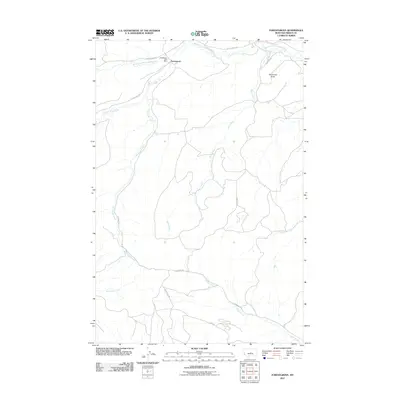
2011 Map of Forestgrove
USGS Topo · Published 2011About this map
Forestgrove Post Office serves as the central hub for this rural stretch of Fergus County, Montana, situated near the banks of the South Fork McDonald Creek. The landscape is defined by a network of drainage systems, most notably Surenough Creek and Bear Creek, which carve through the terrain south of the primary settlement. The prominence of McDonald Butte in the northeast provides a clear landmark overlooking the confluence of local roads and waterways. This 2011 survey illustrates a sparse settlement pattern where life is oriented around the primary transit corridors of Forest Grove Rd and Surenuff Rd, connecting isolated homesteads to the postal center and the broader regional water network.
Find a feature on this map
16 named features on this map. Tap any name to fly to it.
Don’t see what you’re looking for? This feature index may not catch every label — zoom into the map to look around manually.
Map Details
Editions of this 2011 Forestgrove Map
This is the sole edition of this map. No revisions or reprints were ever made.
Other maps of this area

1889 · Big Snowy Mountain
USGS Topo · 1:250,000

1893 · Big Snowy Mountain
USGS Topo · 1:250,000

1941 · Judith Peak
USGS Topo · 1:62,500

1944 · Judith Peak
USGS Topo · 1:62,500

1954 · Roundup
USGS Topo · 1:250,000

1954 · Lewistown
USGS Topo · 1:250,000

1958 · Roundup
USGS Topo · 1:250,000

1959 · Lewistown
USGS Topo · 1:250,000

1970 · Forestgrove
USGS Topo · 1:24,000

1970 · South Bench
USGS Topo · 1:24,000