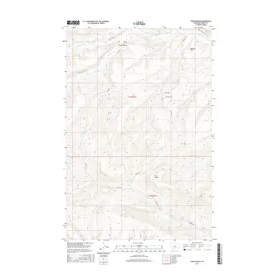
2017 Map of Forestgrove
USGS Topo · Published 2017About this map
Forestgrove sits at the northern edge of this Fergus County landscape, where the prairie begins its ascent into more complex drainages. The settlement's history is anchored by the Forest Grove Cem located nearby, serving as a vital point for genealogists tracing local families. The terrain is defined by a network of seasonal and perennial waterways, including the S Fork McDonald Cr and the curiously named Surenough Cr, which wind through the township divisions of t14n r21e and t13n r21e. To the east, the prominent McDonald Butte rises above the surrounding plains, while the southern portion of the map transitions into the depths of Rose Canyon. This area's infrastructure relies on established routes such as Forest Grove Rd and Surenuff Rd, illustrating a rural Montana ranching and agricultural community maintained well into the twenty-first century.
Find a feature on this map
19 named features on this map. Tap any name to fly to it.
Don’t see what you’re looking for? This feature index may not catch every label — zoom into the map to look around manually.
Map Details
Editions of this 2017 Forestgrove Map
This is the sole edition of this map. No revisions or reprints were ever made.
Other maps of this area

1889 · Big Snowy Mountain
USGS Topo · 1:250,000

1893 · Big Snowy Mountain
USGS Topo · 1:250,000

1941 · Judith Peak
USGS Topo · 1:62,500

1944 · Judith Peak
USGS Topo · 1:62,500

1954 · Roundup
USGS Topo · 1:250,000

1954 · Lewistown
USGS Topo · 1:250,000

1958 · Roundup
USGS Topo · 1:250,000

1959 · Lewistown
USGS Topo · 1:250,000

1970 · Forestgrove
USGS Topo · 1:24,000

1970 · South Bench
USGS Topo · 1:24,000