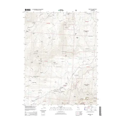
2015 Map of Foresthill
USGS Topo · Published 2015About this map
Foresthill and the historic settlement of Iowa Hill anchor this detailed study of the Placer County gold country. The map traces the deeply incised drainage of the North Fork American River and its numerous tributaries, including Indian Cr and Shirttail Canyon. Long-standing local geography is preserved through landmarks such as Yankee Jims and Grizzly Flat, while genealogical interest is served by the Iowa Hill Cemetery and the Foresthill Protestant Cemetery. The landscape reflects a legacy of extraction and early industry, indicated by Hughes Mill and the proximity of the Tahoe National Forest. Transportation routes like Michigan Bluff Rd and Mosquito Ridge Rd wind through the complex terrain of the Sierra Nevada foothills, connecting various "flats" and "points" that define the local topography.
Find a feature on this map
115 named features on this map. Tap any name to fly to it.
Don’t see what you’re looking for? This feature index may not catch every label — zoom into the map to look around manually.
Map Details
Editions of this 2015 Foresthill Map
This is the sole edition of this map. No revisions or reprints were ever made.
Other maps of this area

1891 · Colfax
USGS Topo · 1:125,000

1891 · Placerville
USGS Topo · 1:125,000

1892 · Placerville
USGS Topo · 1:125,000

1892 · Colfax
USGS Topo · 1:125,000

1893 · Placerville
USGS Topo · 1:125,000

1894 · Colfax
USGS Topo · 1:125,000

1898 · Colfax
USGS Topo · 1:125,000

1900 · Colfax
USGS Topo · 1:125,000

1902 · Colfax
USGS Topo · 1:125,000

1938 · Colfax
USGS Topo · 1:125,000