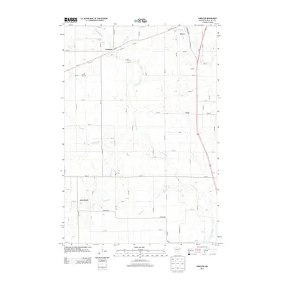
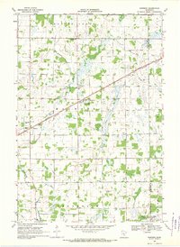
2013 Map of Foreston
USGS Topo · Published 2013About this map
Foreston and the surrounding agricultural landscape of Mille Lacs County are defined by the winding course of the W Br Rum River. This modern survey illustrates the persistent rural grid of central Minnesota, where small settlements like Pease and Estes Brook serve as local anchors. For genealogists, the map identifies several key burial sites, including Saint Louis Cem near Foreston, Pilgrims Rest Cem further west, and Milo Cem situated near the southern boundary. The drainage pattern is complex, with the Estes Brook waterway meandering through the southwestern quadrant to join the river system. Transportation is centered on the intersection of MN-23 and Us-169, which facilitates movement toward Milaca in the northeast. The presence of these traditional cemeteries alongside modern highway developments provides a clear view of how these communities have maintained their footprint over decades of growth.
Find a feature on this map
55 named features on this map. Tap any name to fly to it.
Don’t see what you’re looking for? This feature index may not catch every label — zoom into the map to look around manually.
Map Details
Editions of this 2013 Foreston Map
This is the sole edition of this map. No revisions or reprints were ever made.
Other maps of this area

1953 · Stillwater
USGS Topo · 1:250,000

1955 · Stillwater
USGS Topo · 1:250,000

1958 · Stillwater
USGS Topo · 1:250,000

1965 · Stillwater
USGS Topo · 1:250,000

1968 · Rum River
USGS Topo · 1:24,000
1968 · Santiago
USGS Topo · 1:24,000
1968 · Princeton SW
USGS Topo · 1:24,000

1968 · Milaca
USGS Topo · 1:24,000
1968 · Princeton
USGS Topo · 1:24,000
1968 · Ronneby
USGS Topo · 1:24,000