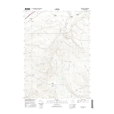
2016 Map of Forestville
USGS Topo · Published 2016About this map
Forestville and its surrounding hamlets occupy a landscape shaped by the headwaters of several notable Lake Erie tributaries. This part of Chautauqua County is defined by its deep historical roots, evidenced by the numerous burial grounds marking the hillsides, such as the Pioneer Cem and Sheridan Center Cem. The terrain rises from the lower reaches near Sheridan toward the high ground at Pope Hill and Round Top Hill in the south. Several small settlements like Hawkins Corner and Black Corners are linked by a network of rural roads that cross over Walnut Cr and the W Br Conewango Cr. This 2016 survey captures a late-era view of the region's agricultural and rural residential character, preserving the location of family-named landmarks like Ball Hill Cem and Abbey Cem for local researchers.
Find a feature on this map
77 named features on this map. Tap any name to fly to it.
Don’t see what you’re looking for? This feature index may not catch every label — zoom into the map to look around manually.
Map Details
Editions of this 2016 Forestville Map
This is the sole edition of this map. No revisions or reprints were ever made.
Other maps of this area

1899 · Silver Creek
USGS Topo · 1:62,500

1900 · Dunkirk
USGS Topo · 1:62,500

1900 · Cherry Creek
USGS Topo · 1:62,500

1941 · Cherry Creek
USGS Topo · 1:62,500

1943 · Dunkirk
USGS Topo · 1:62,500

1943 · Silver Creek
USGS Topo · 1:24,000

1944 · Farnham
USGS Topo · 1:31,680

1944 · Silver Creek
USGS Topo · 1:31,680
1954 · Hamlet
USGS Topo · 1:24,000

1954 · Forestville
USGS Topo · 1:24,000