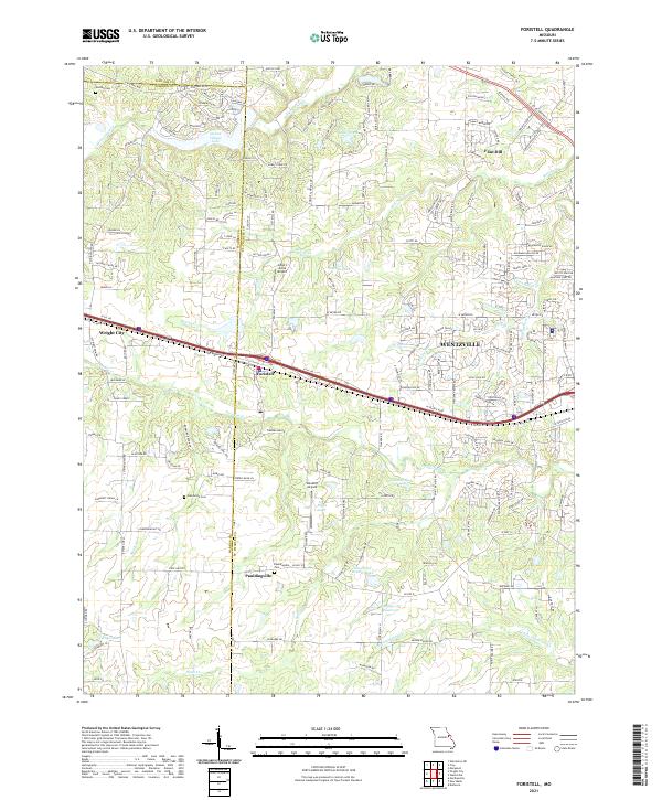
2021 Map of Foristell
USGS Topo · Published 2021About this map
The Western edge of Wentzville and the neighboring communities of Foristell and Pauldingville anchor this 2021 landscape across the Lincoln and Warren County line. The terrain is defined by the headwaters of McCoy Creek and Peruque Creek, which carve through the undulating hills toward the Missouri River drainage. This area showcases the transition from the dense residential developments of Incline Village Lake and Flint Hill to the more open, agriculturally rooted lands further west in Wright City. Local history is preserved at sites like Oak Grove Cemetery and Metcalf Cemetery, while landmarks like Helliger Hill and several private landing strips, including Ahlers Acres Airport and Woodliff Airpark, characterize the modern utility of the land. The network of creeks, such as Indian Camp Creek and Sams Creek, remains a primary geographic constant amid the evolving suburban sprawl.
Find a feature on this map
170 named features on this map. Tap any name to fly to it.
Don’t see what you’re looking for? This feature index may not catch every label — zoom into the map to look around manually.
Map Details
Editions of this 2021 Foristell Map
This is the sole edition of this map. No revisions or reprints were ever made.
Other maps of this area

1890 · Hermann
USGS Topo · 1:125,000

1903 · O'Fallon
USGS Topo · 1:125,000

1941 · Troy
USGS Topo · 1:62,500

1943 · Warrenton
USGS Topo · 1:62,500

1945 · Troy
USGS Topo · 1:62,500

1945 · Warrenton
USGS Topo · 1:62,500

1948 · Washington
USGS Topo · 1:62,500

1948 · Augusta
USGS Topo · 1:62,500

1949 · Saint Louis
USGS Topo · 1:250,000
1949 · Washington
USGS Topo · 1:62,500