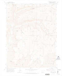
1971 Map of Forked Gulch
USGS Topo · Published 1974About this map
The Naval Oil Shale Reserve dominates this 1970s landscape in Garfield County, reflecting a period of intense focus on domestic energy development and industrial extraction. Centered on the rugged high-country drainages of Parachute Creek and its many forks, the map documents an extensive network of infrastructure, including an Oil Shale Plant and numerous Drill Hole locations. This industrial activity is superimposed on a landscape defined by sharp topographical features and family-named landmarks like Lindauer Point, Glover Point, and Schoolhouse Point.
Find a feature on this map
49 named features on this map. Tap any name to fly to it.
Don’t see what you’re looking for? This feature index may not catch every label — zoom into the map to look around manually.
Map Details
Editions of this 1971 Forked Gulch Map
This is the sole edition of this map. No revisions or reprints were ever made.
Other maps of this area

1906 · Grand Hogback
USGS Topo · 1:125,000

1910 · Grand Hogback
USGS Topo · 1:125,000

1925 · Parachute Creek
USGS Topo · 1:62,500

1927 · Parachute Creek
USGS Topo · 1:62,500

1929 · Grand Valley
USGS Topo · 1:62,500

1952 · Rio Blanco
USGS Topo · 1:24,000

1952 · Anvil Points
USGS Topo · 1:24,000

1956 · Grand Junction
USGS Topo · 1:250,000

1957 · Leadville
USGS Topo · 1:250,000

1959 · Grand Junction
USGS Topo · 1:250,000