
1962 Map of Forked Horn Butte
USGS Topo · Published 1963About this map
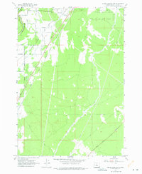
Forked Horn Butte and the surrounding high desert of central Oregon appear in this early 1960s study, revealing the vital irrigation infrastructure necessary for the region's development. The landscape is defined by an intricate network of waterways, including the Bend Lateral Canal, South Canal, and the large North Unit Main Canal, which feed the arid plains east of the Deschutes River. Near the western edge, the Redmond Pumping Plant and a local Filtration Plant underscore the importance of water management for the growing community of Redmond.
Find a feature on this map
26 named features on this map. Tap any name to fly to it.
Don’t see what you’re looking for? This feature index may not catch every label — zoom into the map to look around manually.
Map Details
Editions of this 1962 Forked Horn Butte Map
2 editions found
Other maps of this area

1926 · Bend
USGS Topo · 1:125,000

1929 · Bend
USGS Topo · 1:125,000

1955 · Bend
USGS Topo · 1:250,000

1957 · Bend
USGS Topo · 1:250,000

1958 · Bend
USGS Topo · 1:250,000

1961 · Redmond
USGS Topo · 1:24,000
1962 · Bend
USGS Topo · 1:24,000

1962 · Oneil
USGS Topo · 1:24,000
1962 · Bend Airport
USGS Topo · 1:24,000
1962 · Redmond
USGS Topo · 1:24,000