
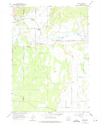
1962 Map of Oneil
USGS Topo · Published 1963About this map
The Crooked River dominates this Central Oregon landscape, carving through the remarkable Crooked River Gorge as it passes from Deschutes into Crook County. This early 1960s survey illustrates a rural region defined by its water management, where the North Unit Canal, Pilot Butte Canal, and Lone Pine Canal distribute resources across the arid terrain of Lone Pine Flat.
Find a feature on this map
32 named features on this map. Tap any name to fly to it.
Don’t see what you’re looking for? This feature index may not catch every label — zoom into the map to look around manually.
Map Details
Editions of this 1962 Oneil Map
2 editions found
Other maps of this area

1926 · Bend
USGS Topo · 1:125,000

1929 · Bend
USGS Topo · 1:125,000

1955 · Bend
USGS Topo · 1:250,000

1957 · Bend
USGS Topo · 1:250,000

1958 · Bend
USGS Topo · 1:250,000

1961 · Redmond
USGS Topo · 1:24,000

1962 · Opal City
USGS Topo · 1:24,000

1962 · Forked Horn Butte
USGS Topo · 1:24,000

1962 · Huston Lake
USGS Topo · 1:24,000
1962 · Redmond
USGS Topo · 1:24,000