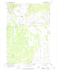
1962 Map of Oneil
USGS Topo · Published 1975About this map
The Crooked River carves a dramatic path through the landscape of central Oregon, defined here by the deep Crooked River Gorge and the irrigation infrastructure of Lone Pine Flat. Mapping in the early 1960s reveals an agricultural region heavily reliant on water management, evidenced by the Main Canal, North Canal, and South Canal that network across the terrain. The small community of O'Neil serves as a focal point along the O'Neil Highway, while the name Lone Pine School Rd preserves the memory of local education hubs.
Find a feature on this map
36 named features on this map. Tap any name to fly to it.
Don’t see what you’re looking for? This feature index may not catch every label — zoom into the map to look around manually.
Map Details
Editions of this 1962 Oneil Map
2 editions found
Other maps of this area

1926 · Bend
USGS Topo · 1:125,000

1929 · Bend
USGS Topo · 1:125,000

1955 · Bend
USGS Topo · 1:250,000

1957 · Bend
USGS Topo · 1:250,000

1958 · Bend
USGS Topo · 1:250,000

1961 · Redmond
USGS Topo · 1:24,000

1962 · Opal City
USGS Topo · 1:24,000

1962 · Forked Horn Butte
USGS Topo · 1:24,000

1962 · Oneil
USGS Topo · 1:24,000

1962 · Huston Lake
USGS Topo · 1:24,000