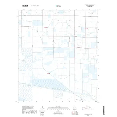
2018 Map of Forked Island NW
USGS Topo · Published 2018About this map
Low-lying marshlands and structured drainage systems characterize this 2018 coastal landscape in Vermilion Parish. The southern portion of the map is dominated by the Intracoastal Waterway and the Warren Canal, where the terrain transitions into the wetlands surrounding Pine Island. This area highlights the critical water management and transportation infrastructure necessary for life in the Louisiana wetlands, with numerous north-south canals like the Maree Michel Canal and Robins Canal cutting through the agricultural parcels. Family heritage is deeply rooted in the local geography, visible through landmarks such as the Marceaux Cem and Broussard Cem. The grid of rural roads, including Saltzman Rd and Len Guidry Rd, reflects a history of divided land tracts and small-scale aviation at Tee Brad's Airport.
Find a feature on this map
44 named features on this map. Tap any name to fly to it.
Don’t see what you’re looking for? This feature index may not catch every label — zoom into the map to look around manually.
Map Details
Editions of this 2018 Forked Island NW Map
This is the sole edition of this map. No revisions or reprints were ever made.
Other maps of this area

1946 · Morse
USGS Topo · 1:31,680

1946 · Schooner Bayou SE
USGS Topo · 1:31,680

1946 · Schooner Bayou NE
USGS Topo · 1:31,680

1946 · Schooner Bayou NW
USGS Topo · 1:31,680

1946 · Kaplan
USGS Topo · 1:31,680

1946 · Schooner Bayou SW
USGS Topo · 1:31,680

1949 · Gueydan
USGS Topo · 1:31,680

1952 · Lake Charles
USGS Topo · 1:250,000

1953 · Jacks Point Island
USGS Topo · 1:24,000

1954 · Grand Lake East SE
USGS Topo · 1:31,680