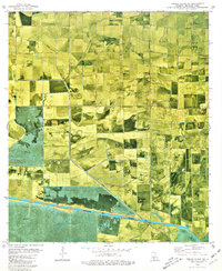
1979 Map of Forked Island NW
USGS Topo · Published 1980About this map
The low-lying coastal prairie and marshlands of Vermilion Parish are defined here by an intricate network of drainage and irrigation infrastructure, notably the Intracoastal Waterway running across the southern reaches. This 1970s landscape reveals the heavy influence of the local petroleum industry, with numerous Oil Wells, Gas Wells, and a dedicated Pumping Station situated among the agricultural plots. Evidence of family history and community life is visible at St Davids Ch and the Marceaux Cem, while transportation is facilitated by the Louisiana-Meridian Canal and a Ferry crossing the main waterway. The reliance on water management for rice farming or pasture is underscored by specialized structures like a Flume and several Siphon points connecting the Spencer Canal and Kaplan Canal.
Find a feature on this map
24 named features on this map. Tap any name to fly to it.
Don’t see what you’re looking for? This feature index may not catch every label — zoom into the map to look around manually.
Map Details
Editions of this 1979 Forked Island NW Map
This is the sole edition of this map. No revisions or reprints were ever made.
Other maps of this area

1946 · Morse
USGS Topo · 1:31,680

1946 · Schooner Bayou SE
USGS Topo · 1:31,680

1946 · Schooner Bayou NE
USGS Topo · 1:31,680

1946 · Schooner Bayou NW
USGS Topo · 1:31,680

1946 · Kaplan
USGS Topo · 1:31,680

1946 · Schooner Bayou SW
USGS Topo · 1:31,680

1949 · Gueydan
USGS Topo · 1:31,680

1952 · Lake Charles
USGS Topo · 1:250,000

1953 · Jacks Point Island
USGS Topo · 1:24,000

1954 · Grand Lake East SE
USGS Topo · 1:31,680