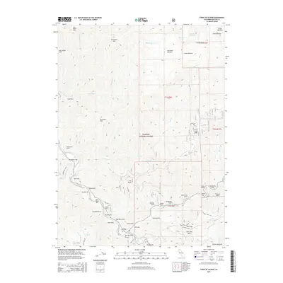
2015 Map of Forks of Salmon
USGS Topo · Published 2015About this map
The South Fork Salmon River and North Fork Salmon River converge within the Klamath National Forest, defining a landscape of deep gulches and isolated riverside settlements. This 2015 survey details the rugged topography of the Marble Mountains region, where names like Knudsen Bar, Fong Wah Bar, and Glasgow Bar recall the area's rich history of river-based commerce and habitation. Higher elevations are marked by distinctive landmarks such as Portuguese Peak and the high alpine waters of Chimney Rock Lake and Picayune Lake.
Find a feature on this map
73 named features on this map. Tap any name to fly to it.
Don’t see what you’re looking for? This feature index may not catch every label — zoom into the map to look around manually.
Map Details
Editions of this 2015 Forks of Salmon Map
This is the sole edition of this map. No revisions or reprints were ever made.
Other maps of this area

1948 · Weed
USGS Topo · 1:250,000

1950 · Weed
USGS Topo · 1:250,000

1955 · Salmon Mtn
USGS Topo · 1:62,500

1955 · Cecilville
USGS Topo · 1:62,500

1955 · Sawyers Bar
USGS Topo · 1:62,500

1955 · Forks of Salmon
USGS Topo · 1:62,500

1958 · Weed
USGS Topo · 1:250,000

1963 · Weed
USGS Topo · 1:250,000

1974 · Orleans Mtn.
USGS Topo · 1:24,000
1977 · English Peak
USGS Topo · 1:24,000