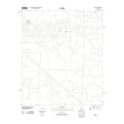
2010 Map of Forsan
USGS Topo · Published 2010About this map
The Howard Glasscock Oil Field dominates the central landscape of this Howard County region, illustrating the long-standing petroleum industry that has shaped the local economy. The settlement of Forsan sits in the northwest corner, serving as a primary hub connected by a network of rural routes including 1 Mile Rd and Bowhunter Rd. To the east, the smaller community of Ross City and the outlying area of Otis Chalk mark the transition toward more open ranch land.
Find a feature on this map
13 named features on this map. Tap any name to fly to it.
Don’t see what you’re looking for? This feature index may not catch every label — zoom into the map to look around manually.
Map Details
Editions of this 2010 Forsan Map
This is the sole edition of this map. No revisions or reprints were ever made.
Other maps of this area

1941 · Big Spring South
USGS Topo · 1:62,500

1942 · Big Spring South
USGS Topo · 1:62,500

1954 · Big Spring
USGS Topo · 1:250,000

1954 · San Angelo
USGS Topo · 1:250,000

1958 · San Angelo
USGS Topo · 1:250,000

1958 · Big Spring
USGS Topo · 1:250,000

1963 · Ballinger Ranch
USGS Topo · 1:24,000

1963 · Hayrick Mountain
USGS Topo · 1:24,000
1963 · Hyman
USGS Topo · 1:24,000

1963 · Garden City NE
USGS Topo · 1:24,000