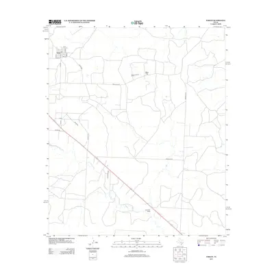
2012 Map of Forsan
USGS Topo · Published 2012About this map
Forsan and the neighboring settlement of Ross City anchor this West Texas landscape, shaped by the enduring presence of the energy industry. The Howard Glasscock Oil Field dominates the central portion of the quadrangle, with a network of access roads like Ranch Road 821 and McDonald Rd N providing the primary infrastructure for the area's oil operations. The terrain is defined by natural drainage patterns, most notably the upper reaches of the N Concho River and the uniquely named Cannibal Draw which carves through the southern landscape. Smaller watercourses such as Bull Cr and Dobson Cr flow through the eastern and northern reaches, respectively. This survey captures a moment in the early 21st century where the traditional grid of city streets like Avenue A and 1st St in Forsan meets the sprawling, industrial layout of the surrounding Permian Basin oil fields.
Find a feature on this map
25 named features on this map. Tap any name to fly to it.
Don’t see what you’re looking for? This feature index may not catch every label — zoom into the map to look around manually.
Map Details
Editions of this 2012 Forsan Map
This is the sole edition of this map. No revisions or reprints were ever made.
Other maps of this area

1941 · Big Spring South
USGS Topo · 1:62,500

1942 · Big Spring South
USGS Topo · 1:62,500

1954 · Big Spring
USGS Topo · 1:250,000

1954 · San Angelo
USGS Topo · 1:250,000

1958 · San Angelo
USGS Topo · 1:250,000

1958 · Big Spring
USGS Topo · 1:250,000

1963 · Ballinger Ranch
USGS Topo · 1:24,000

1963 · Hayrick Mountain
USGS Topo · 1:24,000
1963 · Hyman
USGS Topo · 1:24,000

1963 · Garden City NE
USGS Topo · 1:24,000