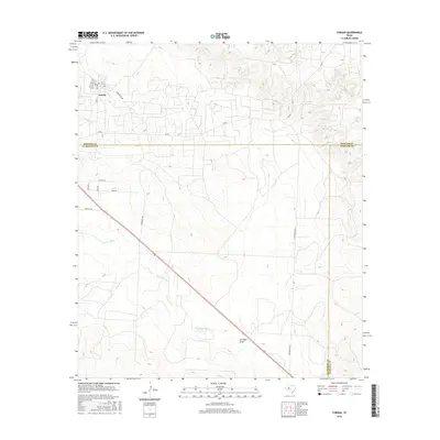
2016 Map of Forsan
USGS Topo · Published 2016About this map
Forsan sits at the northern edge of this West Texas landscape, where Howard, Glasscock, and Sterling counties meet. The settlement is centered around a small grid of streets including Main St and 6th St, with a local Po serving the community. This 2016 survey illustrates a transition from the town's organized layout into the more irregular drainage patterns of the Edwards Plateau. The terrain is defined by the headwaters and branches of the Concho River system, including the N Concho River and S Concho River. These waterways, along with features like Cannibal Draw and Dobson Cr, dictate the placement of ranch roads such as Sisson Rd and McDonald Rd. The map provides a clear view of the rural infrastructure at the intersection of three counties, preserving the names of local thoroughfares like Bowhunter Rd and Reed Rd that link isolated homesteads to the regional center.
Find a feature on this map
26 named features on this map. Tap any name to fly to it.
Don’t see what you’re looking for? This feature index may not catch every label — zoom into the map to look around manually.
Map Details
Editions of this 2016 Forsan Map
This is the sole edition of this map. No revisions or reprints were ever made.
Other maps of this area

1941 · Big Spring South
USGS Topo · 1:62,500

1942 · Big Spring South
USGS Topo · 1:62,500

1954 · Big Spring
USGS Topo · 1:250,000

1954 · San Angelo
USGS Topo · 1:250,000

1958 · San Angelo
USGS Topo · 1:250,000

1958 · Big Spring
USGS Topo · 1:250,000

1963 · Ballinger Ranch
USGS Topo · 1:24,000

1963 · Hayrick Mountain
USGS Topo · 1:24,000
1963 · Hyman
USGS Topo · 1:24,000

1963 · Garden City NE
USGS Topo · 1:24,000