2022 Map of Forsan
USGS Topo · Published 2022About this map
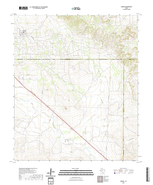
Forsan anchors the northern edge of this West Texas landscape, where the street grid transitions into a network of ranch and farm roads. The town is situated at the junction of FM 461 and FM 821, with local thoroughfares like Teachers Rd and Bowhunter Rd serving the surrounding plains. To the south, the terrain is defined by the headwaters of the N Concho River, which cuts a diagonal course across the landscape toward the southeast. The geography is further marked by several drainage features including Dobson Cr, Cannibal Draw, and Bull Cr. This map captures a three-county intersection where the borders of Howard, Glasscock, and Sterling counties meet, illustrating the parceling of land in this semi-arid region where roads such as McDonald Rd and Overton Rd follow the cardinal directions of the original surveys.
Find a feature on this map
23 named features on this map. Tap any name to fly to it.
Don’t see what you’re looking for? This feature index may not catch every label — zoom into the map to look around manually.
Map Details
Editions of this 2022 Forsan Map
This is the sole edition of this map. No revisions or reprints were ever made.