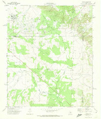
1971 Map of Forsan
USGS Topo · Published 1974About this map
The community of Forsan sits at the northern edge of this West Texas landscape, documented during a period of transition in the early 1970s. The town's layout includes a High Sch and several Water Tanks, markers of its essential infrastructure in an arid region. Stretching south from the Howard County line, the terrain is defined by the winding course of the North Concho River and several significant ephemeral drainages like Cannibal Draw and Deep Creek. This survey reveals the industrial footprint of the era through a dense network of Pipeline corridors and scattered Gravel Pits, particularly around the small settlement of Ross City. The map captures the meeting of three counties—Howard, Glasscock, and Sterling—providing a detailed record of land use where agricultural ranching meets the extraction industries that shaped the local economy. A small Cem and Dabney Spring offer specific points of interest for those tracing the early settlement patterns of the Concho valley.
Find a feature on this map
22 named features on this map. Tap any name to fly to it.
Don’t see what you’re looking for? This feature index may not catch every label — zoom into the map to look around manually.
Map Details
Editions of this 1971 Forsan Map
This is the sole edition of this map. No revisions or reprints were ever made.
Other maps of this area

1941 · Big Spring South
USGS Topo · 1:62,500

1942 · Big Spring South
USGS Topo · 1:62,500

1954 · Big Spring
USGS Topo · 1:250,000

1954 · San Angelo
USGS Topo · 1:250,000

1958 · San Angelo
USGS Topo · 1:250,000

1958 · Big Spring
USGS Topo · 1:250,000

1963 · Ballinger Ranch
USGS Topo · 1:24,000

1963 · Hayrick Mountain
USGS Topo · 1:24,000
1963 · Hyman
USGS Topo · 1:24,000

1963 · Garden City NE
USGS Topo · 1:24,000